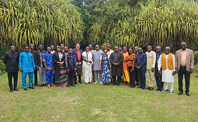
As part of the project to develop the Zoning Master Plan for the National Territory of Cameroon (PTZN), a training session on initiating the design and use of GIS and techniques for informing and consulting local actors was held in Kribi from July 21 to 25, 2025, for twenty (20) participants selected from among government agencies with a significant impact on land use and representatives of Decentralized Territorial Authorities.
The program included: GIS, territorial dialogue, and conflict management.
Led by experts, the training covered three major areas:
- Introduction to the use of GIS: Mastering cartographic tools for land use planning.
- Communication/information techniques for local actors and facilitation: Mobilizing and informing local stakeholders.
- Conflict prevention and management and support for the decision-making process: Methods to facilitate inclusive decision-making processes.
The goal was to equip participants with the skills needed to develop a draft zoning plan, manage databases, monitor its evaluation, and, above all, facilitate dialogue while preventing conflicts.
A national project
The development of the PZTN is a collaborative and inclusive process. It is based on collective reflection and consultation with Cameroonian civil society as well as technical and financial partners.
Project Title: Zoning Master Plan for the National Territory of Cameroon
Country: Cameroon
Client: Ministry of Economy, Planning, and Regional Development (MINEPAT)
Funding: State Budget
Role: Team leader (Partner with ST2I & BETA Consult)


TO READ ALSO

Development of the national road safety policy and strategy as part of institutional support to the National Road Safety Agency (ANASER)

As part of the “Technical assistance for the study of the feasibility requirements

As part of the first optional period of the mission